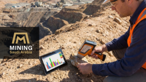
Mining exploration is changing as new technologies reshape how geologists collect and analyze field data. One of the most noticeable shifts recently is the growing use of drones in mining exploration, allowing teams to survey large and difficult terrains faster and with greater precision.
Why Are Drones Becoming Essential in Modern Geological Surveying?
The use of UAVs in geological work is no longer just an added advantage. In many exploration projects, it has become a practical necessity. Instead of relying only on ground observations, geologists can now collect aerial data that reveals terrain features and geological structures with far greater clarity.
High-Resolution Terrain Models (DEM)
Using photogrammetry and LiDAR systems, drones can produce highly detailed digital elevation models. These centimeter-scale 3D models help geologists analyze structural features such as faults, fractures, and surface variations much more accurately than traditional field mapping alone.
Improved Field Safety
Drones allow teams to survey steep slopes, unstable rock faces, and hard-to-reach locations without putting field crews at risk. This is particularly valuable in rugged exploration areas where direct access can be dangerous.
Faster Data Collection
Areas that once required days or even weeks of fieldwork can now be mapped within a few hours. The data can be processed quickly, allowing exploration teams to make faster and better-informed decisions during early project stages.
How Do Drones in Mining Exploration Transform Structural Analysis?
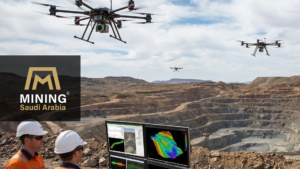
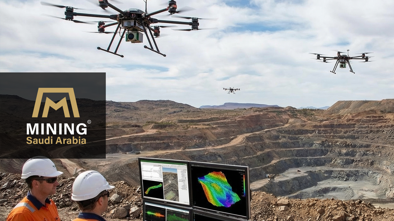
Beyond basic mapping, drones are increasingly used as analytical tools that help geologists study geological structures in much greater detail. By capturing high-resolution aerial imagery and 3D terrain models, UAV technology allows exploration teams to analyze structural features across large areas more efficiently than traditional field mapping alone.
Structural Modeling
Detailed 3D surface models generated from drone imagery allow geologists to identify structural features such as faults, fractures, and folds with greater clarity.
Automated Data Extraction
Specialized software can process drone imagery to calculate measurements, such as strikes and dips, across wide areas, reducing manual measurements and minimizing recording errors.
Time-Lapse Geological Monitoring
Repeated drone surveys make it possible to monitor changes in open-pit mine walls or landslide-prone slopes over time, helping teams evaluate slope stability and structural movement.
How Is Drone Technology Changing the Role of Modern Field Geologists?
A common concern within the geological community is whether new technologies might eventually replace traditional field skills. The short answer is no.
Tools such as drones have significantly improved how geological data is collected, especially in large or difficult terrains. However, these technologies do not replace the role of the geologist. While drones can capture detailed aerial imagery and terrain models, interpreting that data still requires geological experience and field knowledge.
In many exploration projects, drones help reduce repetitive field tasks and allow geologists to focus more on analyzing geological structures, understanding mineral potential, and interpreting complex field conditions. In this way, technology supports the geologist rather than replacing them.
Summary: Key Roles of Drones in Mining Exploration
| Application | How Drones Help | Impact on Exploration |
|---|---|---|
| Terrain Mapping | Capture high-resolution aerial images and generate detailed Digital Elevation Models (DEM). | Improves understanding of surface structures and geological formations. |
| Field Safety | Survey steep slopes, unstable rock faces, and inaccessible areas remotely. | Reduces risks for field crews during early exploration stages. |
| Data Collection Speed | Map large areas in a few hours instead of days or weeks of manual fieldwork. | Accelerates decision-making in early exploration programs. |
| Structural Analysis | Create detailed 3D terrain models that reveal faults, fractures, and folds. | Helps geologists identify structural controls on mineral deposits. |
| Monitoring and Stability | Conduct repeated drone surveys to observe slope changes over time. | Supports slope stability analysis and geological monitoring. |
As drone technology continues to evolve, the role of drones in mining exploration will likely expand further, helping geologists collect more accurate data, improve field safety, and make better exploration decisions.
Read Also: Advanced Remote Sensing Technologies Powering Saudi Arabia’s Mining Future