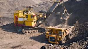
- A high-resolution ground magnetic survey totaling 1,010 line-km has been completed across the ~100 km² Wadi Salamah Project.
- Two extensive, deep-seated magnetic anomalies (H1 and H2) have been delineated in the northern sector, covering approximately 16 km².
- These anomalies are interpreted as large intrusive bodies with strong potential for porphyry-style copper–molybdenum (Cu–Mo) mineralization.
- Six major fault structures (F1 to F6) have been identified, associated with the prolific Najd Fault System corridor.
- Surface sampling has confirmed high-grade mineralization, with peak values reaching 10.66 g/t gold (Au) and 13.95 g/t silver (Ag).
- Three priority exploration zones (Z1, Z2, and Z3) have been defined to support a planned 5,000 m initial drilling program.
Resource Minerals International Ltd (ASX: RMI) has announced the results of a comprehensive ground magnetic survey conducted at its Wadi Salamah Project in the Kingdom of Saudi Arabia. This project complements the company’s second asset, Shaib Marqan, located 150 km to the east. Following successful target identification at Shaib Marqan, the Wadi Salamah results further reinforce the company’s strategy of focusing on high-value structural and magmatic corridors within the Arabian Shield.
The Wadi Salamah Project spans approximately 100.83 km² within the Arabian Shield—an area that remains largely underexplored using modern systematic methods. This survey represents the first phase of structured exploration at the site, providing a critical dataset for defining structural controls and identifying priority drilling targets.
Executive Chairman Asimwe Kabunga commented that the magnetic data is of exceptional quality. The scale of anomalies H1 and H2 suggests the presence of a large magmatic system, which, when combined with previously identified high-grade gold mineralization in the southern structures, positions Wadi Salamah as a highly promising exploration asset.
Project Overview
Wadi Salamah is located in the southwestern part of Riyadh Province, approximately 325 km southwest of Riyadh and 30 km south of Al Khasrah. The project lies within the Murdama Group rocks of the Zaydi Formation, which have undergone folding and intrusion by hypabyssal and plutonic bodies ranging from microgranite to gabbro. Historical mineralization is associated with shear-hosted gold-bearing veins and stockworks, often accompanied by silver, and was previously exploited through small-scale artisanal mining.
High-Resolution Magnetic Survey
The primary objective of the survey was to extend exploration beyond known surface mineralization and identify key structural controls for detecting concealed (“blind”) targets beneath surface cover. The survey was conducted in collaboration with CNNC Geological Science and Technology Co. Ltd., using a GSM-19W Overhauser magnetometer.
A total of 225 survey lines were completed, oriented east–west and spaced at 100 m intervals, with 20 m point spacing. This configuration ensured full coverage of the project area. The resulting datasets include total magnetic field maps as well as first and second vertical derivative maps, enabling enhanced structural interpretation.
Table: Main Structures in Wadi Salamah (Based on Magnetic Survey Results)
| Fault ID | Strike Direction | Basis for Interpretation |
|---|---|---|
| F1 | NW–SE | Strip-shaped low magnetic anomaly |
| F2 | NW–SE | High-amplitude magnetic gradient zone with clear continuity |
| F3 | NE–SW | Distinct magnetic gradient with defined direction and length |
| F4 | N–S / NE–SW | Strong magnetic gradient zone indicating major structural control |
| F5 | NWW–SEE | Linear magnetic gradient zone aligned with regional structures |
| F6 | NW–SE | Continuous high magnetic anomaly, requires field validation |
Structural Architecture
Interpretation of RTP magnetic anomaly data, supported by derivative maps, has identified six major fault structures (F1 to F6) across the project area.
- Faults F1, F2, and F4 exhibit significant scale and continuity.
- Faults F2 and F5 align well with previously known geological features.
- Structural boundaries are defined by sharp magnetic gradient transitions, particularly visible in vertical derivative maps, which also highlight near-surface fault-related features.
Magnetic Interpretation and Targeting
Northern Sector
This area is characterized by polymetallic (Cu–Mo) mineralization associated with magnetic anomaly gradients and intrusive contacts. These features are controlled by lithology and contact zones, with biotite schist serving as a key indicator.
- Z1: Located within high-magnetic anomaly contact zones, this target is considered highly prospective for intrusive-related polymetallic mineralization. These intrusions are interpreted as potential source rocks for Tier-1 porphyry systems.
- Fault F5 is believed to act as a hydrothermal conduit linking F4 with the magnetic anomalies, potentially facilitating mineralization along dyke or contact zones.
- Further investigation is required to determine whether anomaly H1 represents a deep magmatic heat source.
Southern Sector
Gold mineralization in this region is structurally controlled, typically occurring within linear magnetic low zones and at structural intersections. Known mineral occurrences and historical workings align closely with inferred fracture systems.
- Z2: Represents a structurally complex zone favorable for quartz-vein or lode-style gold-silver mineralization. Exploration will focus on identifying concealed altered rock bodies through integrated structural mapping, particularly within the F1–F2–F3 fault network.
- Z3: Located in the eastern portion of the southern sector, this zone hosts surface gold and silver mineralization over a 700 m strike length. Despite weak magnetic signatures—likely due to weathering or the absence of ferromagnetic minerals—it remains highly prospective.
- Multiple NE-trending fracture zones have been identified.
- Subtle NW and N–S trending linear features suggest structural control.
- Historical gold workings and dyke systems further support its exploration potential.
Next Steps
The scale and intensity of anomalies H1 and H2 confirm the presence of a potentially significant mineral system at Wadi Salamah. The company is currently finalizing a 5,000 m diamond and reverse circulation (RC) drilling program aimed at testing both the depth extensions of known gold mineralization and the core zones of copper–molybdenum targets.