For decades, the mining industry has operated on a relatively simple principle: find outcropping rocks, sample them, and dig. However, we have reached a tipping point. Most of the “easy” minerals, those sitting right at the surface, have already been discovered.
Today, the frontiers of mineral exploration lie beneath hundreds of meters of sand, gravel, and sedimentary layers. This is known as sedimentary cover, and it is currently one of the greatest physical barriers to securing the raw materials needed for the global energy transition.
What Is Sedimentary Cover in Mineral Exploration?
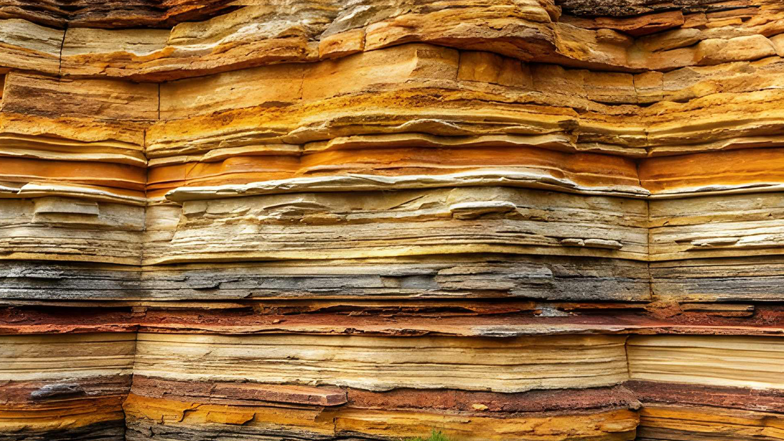
In geological terms, “cover” refers to any material that conceals the ancient, mineral-rich “basement” rocks. This could include the vast sand dunes of the Sahara, the glacial till of Canada, or the thick sedimentary basins of Western Australia.
Sedimentary cover creates a major blind spot for exploration teams. In the past, visible outcrops helped geologists identify areas with mineral potential. But when valuable basement rocks are hidden beneath thick layers of sand, gravel, clay, or sedimentary formations, visual geology becomes much less effective.
This is why under-cover mineral exploration has become one of the most important challenges facing the mining industry today.
Why Sedimentary Cover Creates a Major Exploration Blind Spot
The challenge of sedimentary cover can be compared to trying to identify a specific coin at the bottom of a swimming pool filled with milk. You may know the coin is there, but your eyes are useless. You might try using a magnet, but the milk distorts the signal.
In mineral exploration, traditional geophysical methods face similar hurdles when they are used in covered terrains. The target may exist beneath the surface, but the layers above it interfere with the signals needed to detect it.
Signal Attenuation in Covered Terrains
One of the main challenges in geophysical exploration beneath sedimentary cover is signal attenuation.
Thick layers of conductive clay or saline groundwater can absorb or weaken electromagnetic signals before they reach the ore bodies below. This makes it difficult for exploration teams to get a clear view of what lies beneath the cover.
When the signal is weakened, the quality of subsurface interpretation decreases. As a result, exploration teams may struggle to identify whether a target is worth drilling.
False Positives in Geophysical Exploration
Another challenge is the risk of false positives.
Sedimentary layers often contain their own magnetic or electrical signatures. These signatures can mask the valuable minerals underneath or create signals that appear promising but do not actually represent a real mineral deposit.
This makes interpretation more complex. Exploration teams are not only looking for mineralized systems; they are also trying to separate useful signals from geological noise.
Cost vs. Risk in Under-Cover Drilling
Drilling blindly through 500 meters of sand is prohibitively expensive. Without high-confidence geophysical data, most projects are considered too risky to fund.
This creates a major economic challenge. Companies may suspect that valuable deposits exist beneath cover, but without reliable subsurface data, the cost of testing these targets can be difficult to justify.
Why Traditional Mineral Exploration Methods Are Falling Short
Current exploration workflows often rely on wide-spaced surveys. These surveys are useful for mapping massive continental structures, but they often lack the resolution required to pinpoint a copper or gold deposit hidden beneath sedimentary cover.
This creates a gap between broad regional understanding and precise target identification. Wide-spaced surveys may show that an area is geologically interesting, but they may not provide enough detail to support a multi-million-dollar drilling program.
Furthermore, many existing geophysical models treat sedimentary cover as a “nuisance” to be filtered out. In reality, the cover is a complex system that interacts with the signals sent into the ground.
By ignoring the specific physics of the cover, exploration teams lose the precision needed to justify deeper and more expensive drilling.
Advanced Geophysical Methods for Hidden Mineral Deposits
The core of overcoming the sedimentary cover dilemma lies in moving from simple data collection to integrated geophysical inversion.
The solution is not just “more data.” It is smarter processing, better integration, and a deeper understanding of how different geophysical signals interact with the cover and the basement rocks beneath it.
Deep-Penetrating Electromagnetic Surveys
To “see” through conductive cover, exploration teams are moving toward low-frequency ground-based or airborne electromagnetic systems.
These systems use higher power to punch through the noise of the surface layers, reaching depths of over 500 meters with clarity.
Deep-penetrating electromagnetic surveys are especially important in areas where conductive clay or saline groundwater weakens traditional signals. By using lower frequencies and stronger systems, exploration teams can improve their ability to detect deeper targets beneath cover.
Gravity Gradiometry for Basement Mapping
Where magnetic signals may be masked by volcanic rocks in the cover, gravity can provide another path forward.
Every mineral deposit has a specific density. By measuring minute changes in the Earth’s gravitational pull, gravity gradiometry can help create a 3D map of the basement architecture.
This allows exploration teams to effectively “strip away” the sand in a digital environment and better understand what lies beneath the sedimentary cover.
Gravity gradiometry is therefore not just a supporting tool. It can become a critical part of basement mapping when other geophysical signals are unclear or distorted.
Predictive Cover Modeling and Machine Learning in Mineral Exploration
One of the most important breakthroughs in addressing the sedimentary cover dilemma is predictive cover modeling.
The cornerstone of this proposed solution involves a new algorithm that uses Machine Learning to characterize the cover itself. Instead of filtering the sand out, the model learns the “fingerprint” of the sedimentary layer and subtracts it with surgical precision.
This represents an important shift in how exploration teams think about cover.
Rather than treating sedimentary cover as a nuisance, predictive modeling treats it as a system that can be studied, characterized, and accounted for.
Integrated Geophysical Inversion: Combining Seismic, Gravity, and Electromagnetic Data
The core thesis is that by integrating seismic, gravity, and electromagnetic data into a single joint inversion model, exploration teams can reduce the uncertainty of target depth by up to 40%.
This means they are no longer simply guessing where the basement starts. They are seeing it with greater confidence.
Integrated geophysical inversion brings different datasets together instead of interpreting each method in isolation. Each method contributes a different view of the subsurface:
- Seismic data helps improve understanding of subsurface structures.
- Gravity data supports basement architecture mapping.
- Electromagnetic data helps detect conductive features beneath cover.
When combined into one integrated model, these datasets can provide a more reliable picture of hidden mineral targets.
Why Under-Cover Exploration Matters for the Mining Industry
Solving the sedimentary cover dilemma is not just an academic exercise. It is an economic necessity.
As surface deposits become harder to find, the future of mineral discovery will depend increasingly on the ability to explore beneath sand, gravel, clay, and sedimentary basins.
This is especially important as the demand for energy transition minerals continues to rise.
Critical Minerals and the Global Energy Transition
The World Bank estimates that the production of minerals like copper, lithium, and cobalt must increase by nearly 500% by 2050 to meet climate goals.
Most of these deposits are likely hidden under cover in regions like Africa, South America, and Australia.
This makes under-cover exploration a critical part of the future mineral supply chain. Without better methods for identifying hidden deposits, the industry may struggle to secure the raw materials needed for batteries, electric vehicles, renewable energy systems, and other technologies linked to the global energy transition.
How Advanced Geophysics Reduces Exploration Waste
Currently, only 1 in 1,000 exploration targets becomes a mine.
By providing high-resolution pre-drilling maps, integrated geophysical approaches can help reduce exploration waste and improve decision-making before drilling begins.
Saves Capital by Reducing Dead Holes
High-confidence subsurface maps can reduce the number of “dead” holes drilled into barren rock.
This matters because drilling is one of the most expensive stages of exploration. When companies drill without enough confidence, they risk spending large amounts of capital on targets that do not lead to discovery.
Shortens Exploration Timelines
Better pre-drilling data can also shorten the journey from discovery to production by 2–3 years.
When exploration teams have a clearer understanding of target depth, basement structure, and subsurface conditions, they can make faster and better decisions about where to drill and how to prioritize targets.
Attracts Mining Investment
Lower risk profiles make greenfield exploration more attractive to institutional investors and major mining companies.
Exploration is always risky, but better geophysical data can reduce uncertainty. When uncertainty is lower, investors are more likely to support projects that would otherwise seem too risky.
The Future of Mineral Exploration Beneath Sedimentary Cover
The sedimentary cover dilemma is the final frontier of terrestrial exploration.
As the mining industry exhausts the surface of the planet, it must look deeper. The integration of advanced geophysics and predictive modeling acts as an “X-ray” for the Earth’s crust, turning vast, “empty” deserts into the mineral provinces of tomorrow.
The technology is no longer the bottleneck. The adoption of integrated workflows is now the key.
By embracing these findings, the mining industry can move from a state of “searching” to a state of “finding,” helping ensure a stable supply of the elements that power the modern world.
Read Also: Building a Mineral Economy: Policy, Investment, and Capabilities in Saudi Arabia